2026 Definitive Travel Bucket List & Sights Guide

18 Best Things to Do in Tibet: Top Places of Interest & Sacred Wonders

From the gold-crowned rooftops of Potala Palace and pilgrim-filled Barkhor Street to the turquoise waters of Yamdrok Lake and the colossal north face of Mount Everest.
Tibet Permit: 100% Agency Turnkey
18 Handpicked Sights
Prime Window: April – October
Oxygen-Equipped Private 4WD
Explore All 18 Attractions Request Custom Proposal
c3ce66b1879586e12c94cdcc355a9270
Curated Highlights18 Must-SeesFrom Lhasa to Everest Base Camp
Lhasa Valley Altitude3,650 m (11,975 ft)2-Day Rest & Acclimatization Staging
Tibet Travel Permit100% GuaranteedTurnkey Lhasa Bureau Application
Best Travel WindowApr – Oct 2026Warm Sunshine & Clear Mountain Passes

Crucial Travel Rule: Foreign passport holders cannot enter Tibet attractions independently. All sites require an authorized licensed tour agency, Tibet Travel Permit (TTP), and licensed local guide.

Review 2026 Tibet Permit Guide →

Showing 18 of 18 Tibet Places of Interest

Click the bookmark icon on any sight to save it into your personal wishlist.
3 Sights in Your Wishlist
dbf058428b05e004fd4dbbbde92fb528
Lhasa City Center
3700m (12,140 ft)99/100 Photo Index
Potala Podrang

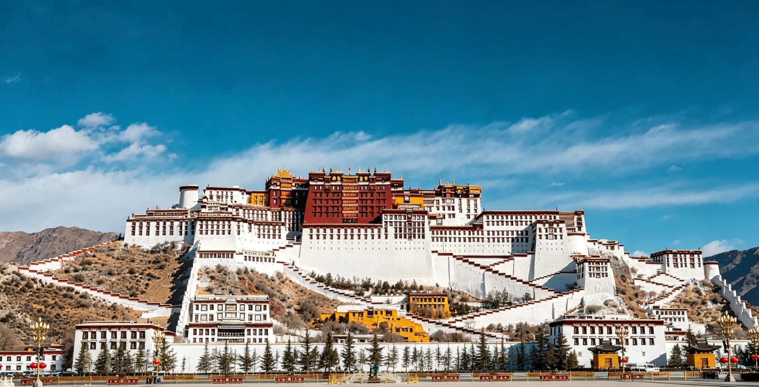
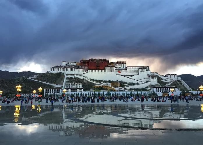
Potala Palace (布达拉宫)

Perched atop Red Mountain (Marpo Ri), the UNESCO-listed Potala Palace was the winter residence of the Dalai Lamas since the 7th century. Its 13 stories, over 1,000 rooms, and iconic red-and-white stone walls dominate the Lhasa skyline as the absolute crown jewel of Tibetan civil architecture.

Climb the grand stone ceremonial staircases overlooking the Lhasa Valley
Gaze upon the 3,721 kg pure gold stupa tomb of the 5th Dalai Lama
Capture the reflection of the palace from the Chakpori Hill observation deck (50 RMB note viewpoint)
Insider Tip:Photography is strictly prohibited once inside the wooden palace chapels. Daily visitor access is capped by the bureau; ensure your tour agency reserves your precise entry time slot at least 7–14 days in advance.
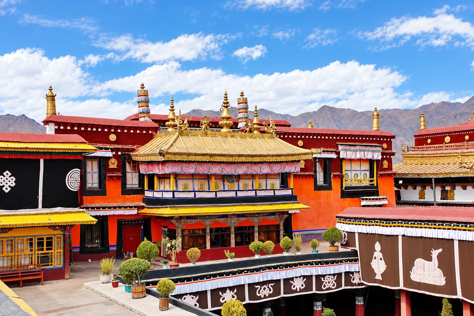
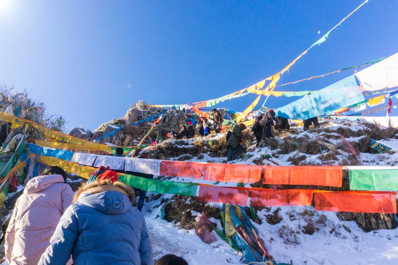
蓝天雪山下的藏式寺院
Barkhor District, Old Lhasa
3650m (11,975 ft)96/100 Photo Index
Tsuglagkhang

Jokhang Temple (大昭寺)

Built in 647 AD by King Songtsen Gampo for his Tang Dynasty bride Princess Wencheng and Nepalese bride Princess Bhrikuti, Jokhang is universally revered as the most sacred and spiritual monastery in the entire Tibetan Buddhist world.

Witness thousands of devout pilgrims performing continuous full-body prostrations
Marvel at the sacred life-sized Jowo Shakyamuni gold statue
Absorb the aroma of thousands of yak-butter lamps flickering in ancient timbered halls
Insider Tip:Head up to the second-floor rooftop terrace late in the afternoon. The golden roofs glowing against the backdrop of Potala Palace in the distance provide one of the most unforgettable vistas in Asia.
198311ec1e5dd34d49a4c9b34c43e432 (1)
Old Quarter, Lhasa
3650m (11,975 ft)95/100 Photo Index
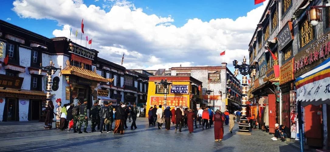
Barkhor

Barkhor Street Kora (八廓街)

A circular historical cobblestone street surrounding Jokhang Temple, Barkhor Street is both Tibet's oldest pilgrim circumambulation circuit (Kora) and a bustling bazaar brimming with prayer wheels, antique shops, street teahouses, and nomadic pilgrims in traditional khata dress.

Join pilgrims spinning prayer wheels in peaceful clockwise devotion
Browse authentic hand-woven Tibetan wool rugs, turquoise jewelry, and incense
Sip traditional salty yak butter tea and sweet milk tea at local outdoor tea shops
Insider Tip:Always walk in a clockwise direction to respect Buddhist custom. Visit Makye Ame—the famous yellow historic restaurant where the 6th Dalai Lama Tsangyang Gyatso wrote his romantic love poetry.
DJI_0949
Nagarze County, Shannan
4441m (14,570 ft)98/100 Photo Index
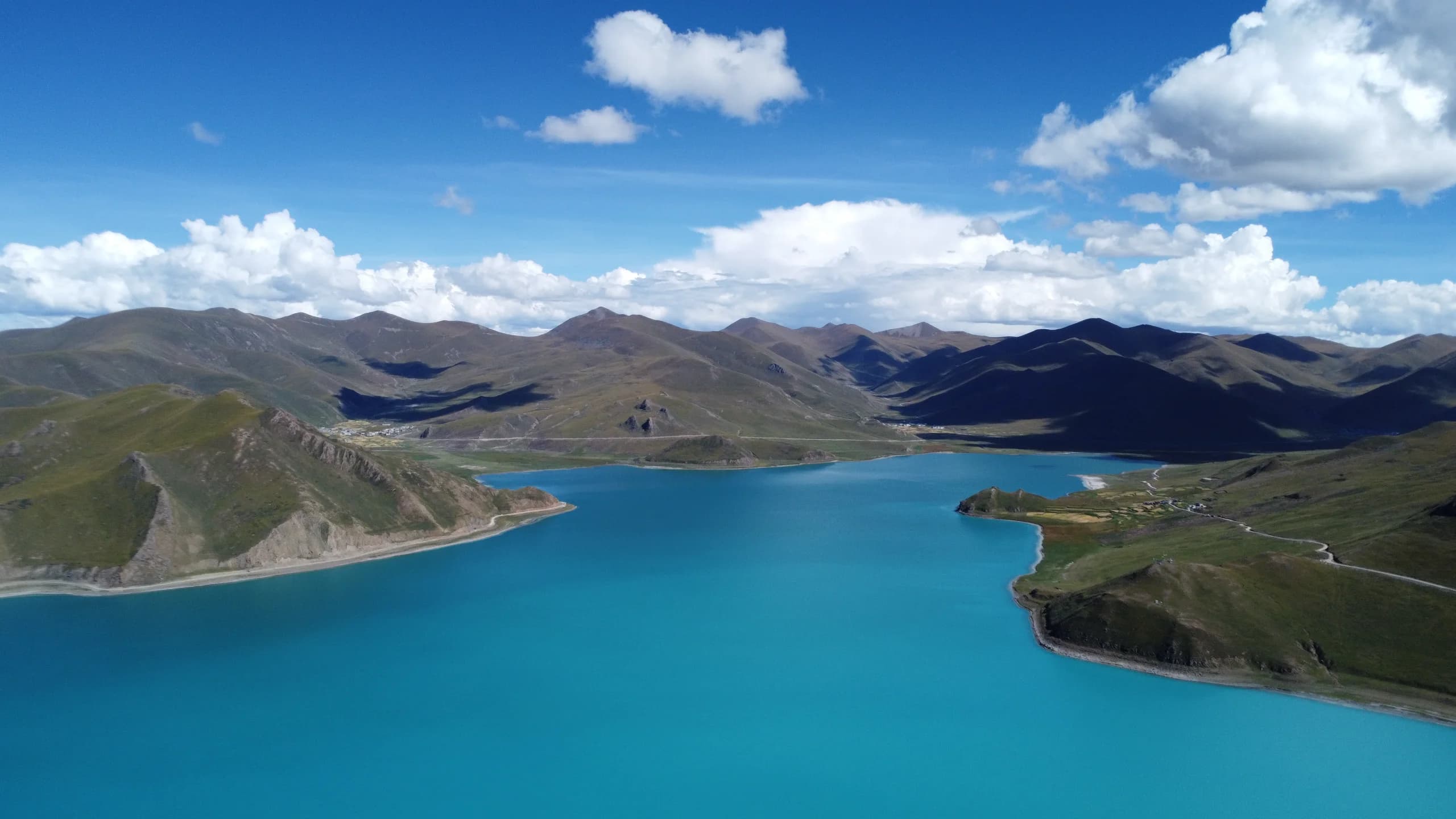
Yamdrok Yumtso

Yamdrok Lake (羊卓雍措)

One of the Three Sacred Lakes of Tibet (alongside Namtso and Lake Manasarovar). Yamdrok Yumtso sprawls across 638 square kilometers like a giant coiled turquoise earring, with finger-like bays wrapped around barren alpine ridges.

Stand at Gampa La Pass (4,990m) for breathtaking 180-degree lake panoramas
Touch the crystal-clear glacial waters at shoreline pebble rest stops
Encounter friendly Tibetan mastiffs and decorated yaks along the scenic viewpoints
Insider Tip:When crossing the Gampa La Pass (4,990m / 16,370 ft), stop at the viewing platform for your first panoramic reveal of the turquoise water contrasting with snow-capped Mount Noijin Kangsang (7,191m).
a75efa17726f94bdeef0689c74e70123
Damxung County, Northern Tibet
4718m (15,479 ft)97/100 Photo Index
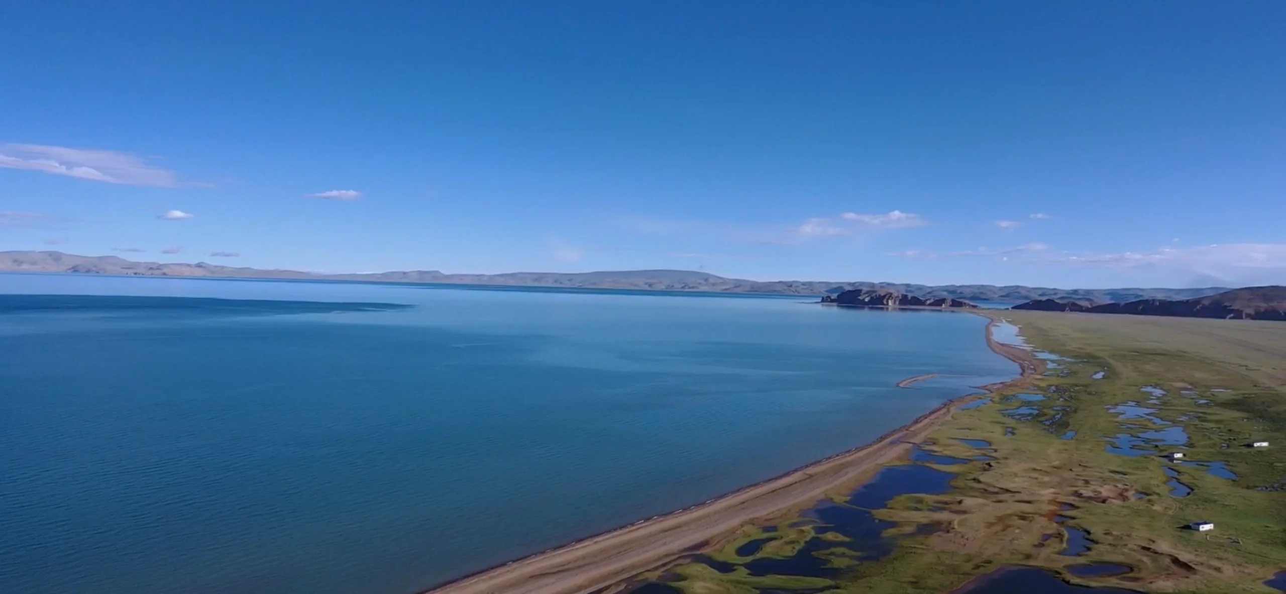
Nam Tso ('Heavenly Lake')

Namtso Lake & Tashi Do Peninsula (纳木措)

At 4,718 meters, Namtso is the second-largest saltwater lake in China and one of the highest alpine lakes in the world. Its glassy sapphire expanse mirrors the jagged glaciated ramparts of the Nyenchen Tanglha mountain range (7,162m).

Explore the holy caves and rocky karst sea-arches of Tashi Do Peninsula
Watch grazing herds of wild black yaks across boundless Changtang grasslands
Witness starry night skies and the Milky Way with almost zero light pollution
Insider Tip:Due to extreme elevation (over 15,400 ft), only visit Namtso after you have spent at least 3–4 days acclimatizing in lower elevations like Lhasa or Nyingchi. Take slow steps and carry emergency aerosol oxygen.
c62db92baef49a5bd3725ad63104c761
Tingri County, Shigatse
5200m (17,060 ft)100/100 Photo Index
Qomolangma Base Camp

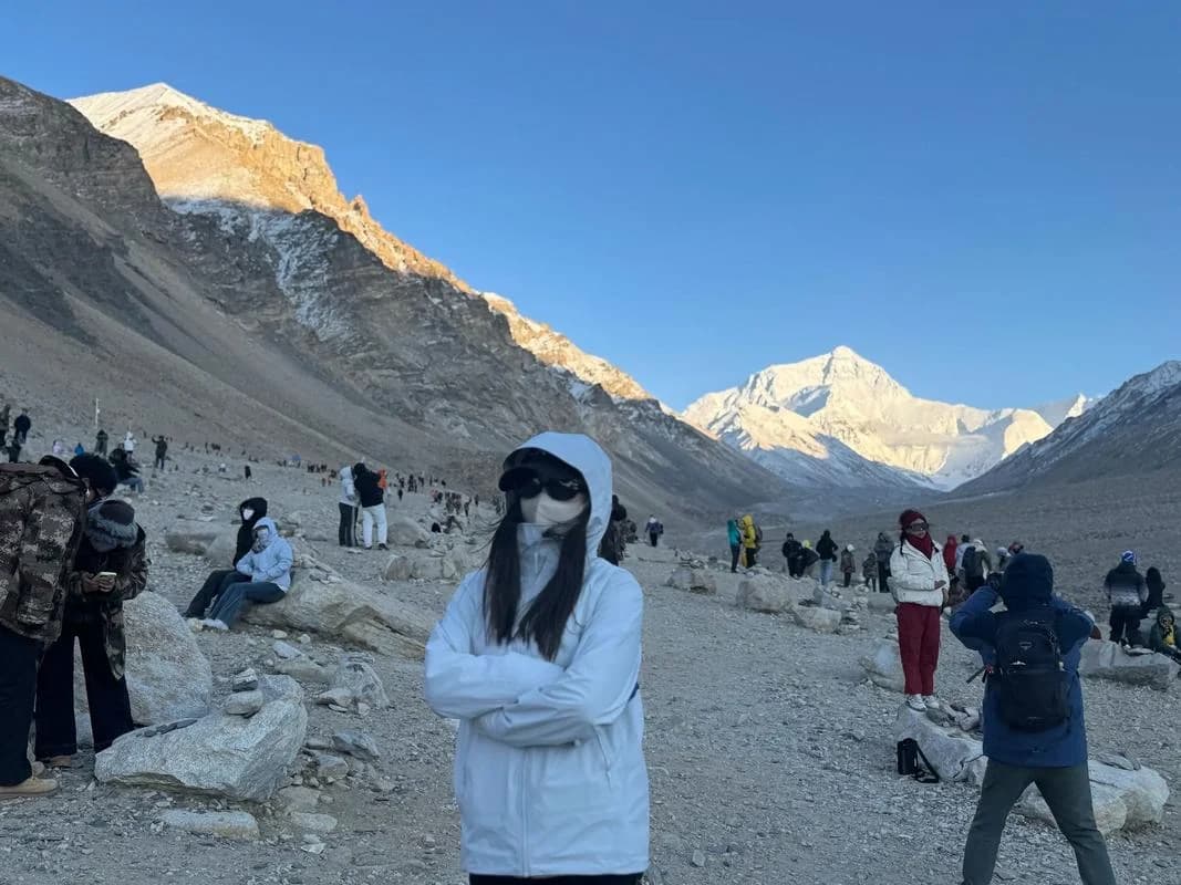
Mount Everest North Base Camp (珠峰大本营)

The northern gateway to the roof of the world. Standing at 5,200 meters directly in front of the colossal Rongbuk Glacier, you face the vertical 3,000-meter north pyramid face of Mount Everest (8,848.86m), free from the fog and cloud cover that often shrouds the southern Nepal side.

Pose beside the official 8,848.86m Everest Summit Monument stone
Visit historic Rongbuk Monastery and light butter lamps in the high sanctuary
Drive the dramatic 108 Bends of Gawula Pass with views of five 8,000-meter Himalayan giants
Insider Tip:Sleep in the heated eco-friendly tourist tent encampment near Rongbuk or at Tingri. Sunset turns the pyramid of Everest into burning golden amber; wake up early for the morning pink sunrise glow.
212902e5559208698a9c546f863d5ae0
Northern Suburbs, Lhasa
3700m (12,140 ft)92/100 Photo Index
Sera Thekchenling

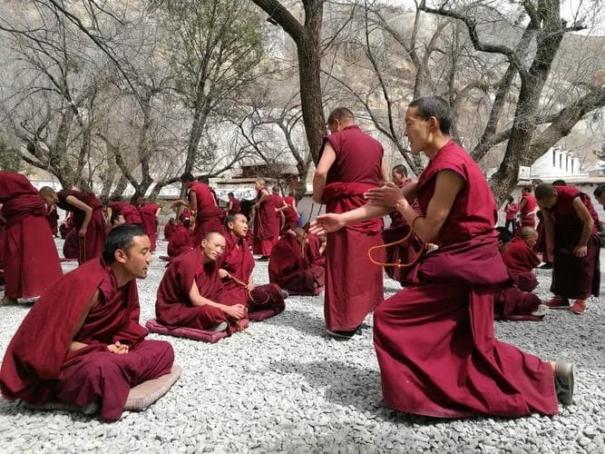
Sera Monastery & Monastic Debates (色拉寺)

One of the 'Great Three' Gelugpa university monasteries of Tibet (founded in 1419). Famous worldwide for its courtyard philosophical debate sessions held every afternoon, where monks vigorously challenge each other on Buddhist logic.

Experience the rhythmic clapping, foot stomping, and sharp questions of debating monks
Explore quiet hillside chapels filled with hundreds of ancient Buddha statues
Visit the famous Hayagriva (horse-necked deity) shrine visited by families seeking blessings
Insider Tip:Debates typically run Monday to Saturday from 3:00 PM to 5:00 PM in the gravel courtyard. Visitors are permitted to photograph the debates with natural light, but do not step onto the monks' gravel debating floor.
5fcb7e2d8da453149d0169af6069e071
Mainling, Nyingchi (G318 Overland)
7782m (25,531 ft)99/100 Photo Index
Namcha Barwa ('Spear Piercing the Sky')

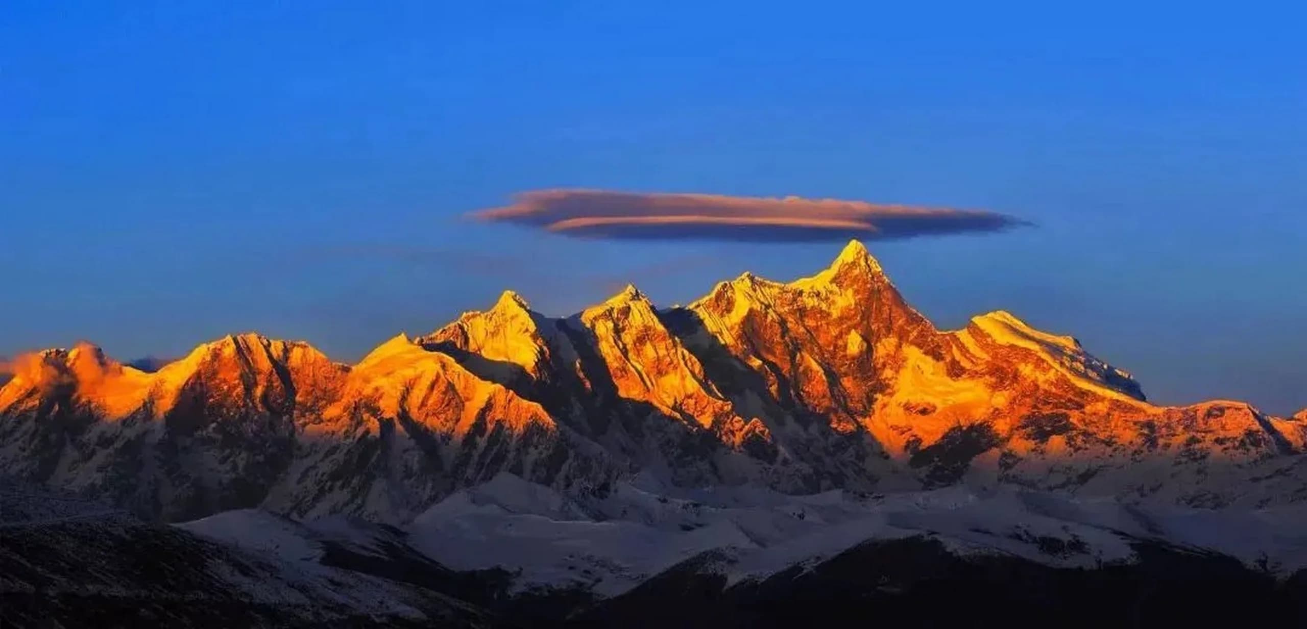
Mount Namcha Barwa (南迦巴瓦峰)

Crowned as China's most beautiful snow peak by Chinese National Geography. Its jagged, spear-like granite summit plunges into the Yarlung Tsangpo Grand Canyon—the deepest terrestrial river canyon on Earth.

Gaze at the massive 5,000-meter sheer vertical rise from riverbed to icy summit
Framed by pink blooming wild peach orchards in April in Nyingchi valleys
Capture the golden summit glow during sunset from Serkhym-la Pass on G318
Insider Tip:The best viewpoints along the G318 Sichuan-Tibet highway are the Serkhym-la Pass viewing platform (4,728m / 15,511 ft) and the scenic wooden observation deck at Suosong Village in the Peach Blossom Valley.
0f5c9c38278524cc96a45726ea93b286
Bomi County (G318 Highway Milestone)
3800m (12,465 ft)94/100 Photo Index
Midui Gangri

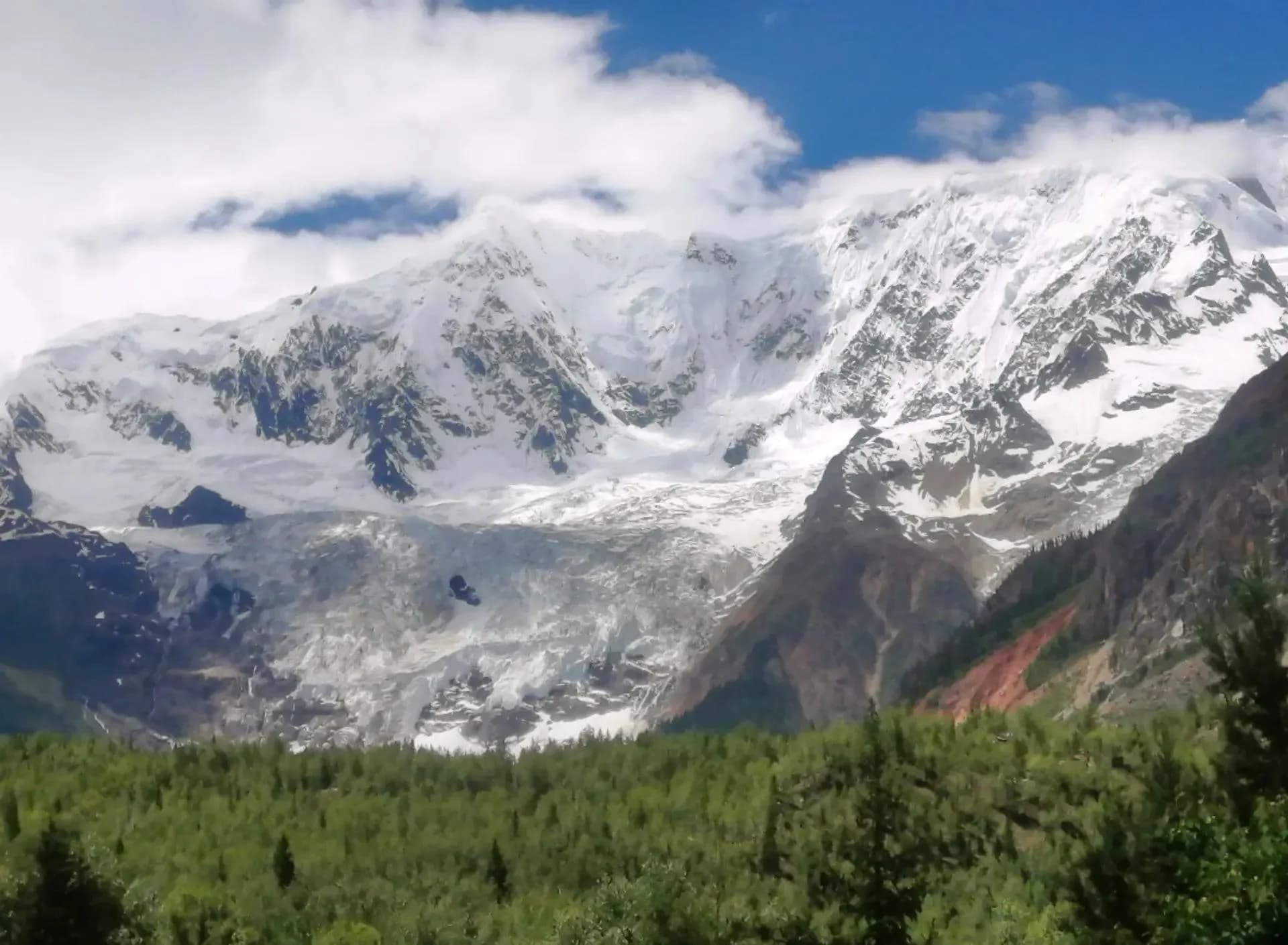
Midui Glacier (米堆冰川)

Recognized as one of China's six most magnificent glaciers, Midui is a maritime hanging glacier descending from 6,800m down to 2,400m into dense primeval spruce forests and a crystal glacial lagoon.

Walk right up to the emerald glacial moraine lake fed by ancient icefalls
Marvel at towering ice seracs and crevasses cascading through virgin alpine woods
Explore idyllic Bomi Tibetan wooden log cabins with wood-shingle roofs
Insider Tip:Take the eco-electric shuttle from the highway ticket pavilion to Midui Tibetan Village, then enjoy an easy 30-minute boardwalk hike to the glacier's frontal moraine lake observation deck.
6ba9c5d88cd75f3831c57265a5ff0246
Baxoi County (G318 Mountain Pass Exit)
3850m (12,630 ft)95/100 Photo Index
Ranwu Tso

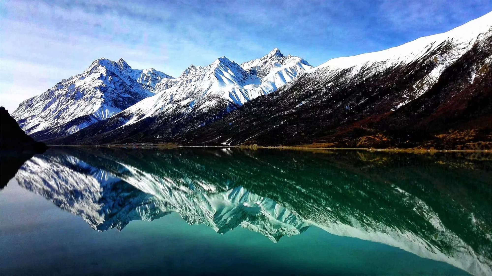
Ranwu Lake (然乌湖)

Formed by prehistoric mountain landslides damming the river, Ranwu Lake is an elongated turquoise jewel split into Upper, Middle, and Lower lakes, with snowy peaks reflecting perfectly across its glassy surface.

Wake up to early morning mist rolling off the glacier into the tranquil lake
Visit the hidden gem of Lhagu Glacier (Laigu) at the upper end of the lake
Sleep in lakefront boutique Tibetan lodges with expansive picture windows
Insider Tip:During early spring (March-April) and late autumn (October-November), the lake water is deeply turquoise and calm as glass. In July and August, monsoon rain carries glacier silt, turning water milky jade.
DJI_0467
Baxoi, Eastern Tibet (G318 Overland)
4658m (15,282 ft)98/100 Photo Index
Yela Pass Switchbacks

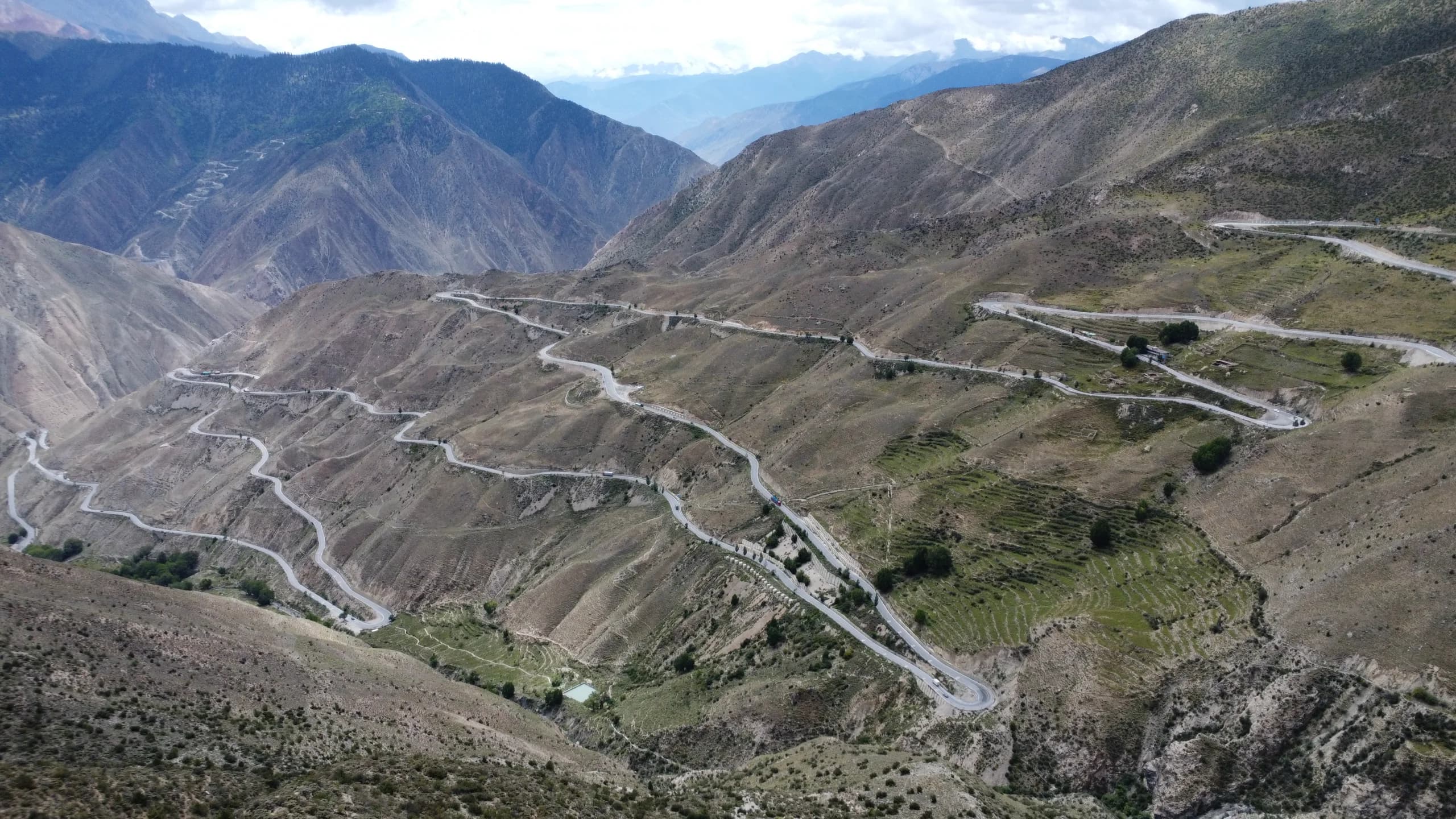
72 Bends of Nujiang River (怒江72拐)

The ultimate highway engineering wonder on National Highway 318. From the crest of Yela Pass at 4,658m, the road drops an astonishing 1,450 vertical meters down into the arid canyon of the raging Nujiang River via 72 dramatic hairpin switchbacks.

Witness one of the most famous driving routes in global adventure travel
Peer into the sheer 1,000-meter deep gorge carved by the untamed Nujiang River
Experience the masterful mountain handling of your dedicated licensed driver
Insider Tip:The modern highway is 100% paved asphalt with sturdy steel crash barriers. Stop at the glass-bottom cantilever viewing platform at Yela Pass summit for the iconic overview photograph.
6c321b7ab04fcd9e0b5ad714488c6c1a
Nyingchi (Eastern Tibet G318)
3300m (10,825 ft)93/100 Photo Index
Lulang ('Dragon King Valley')

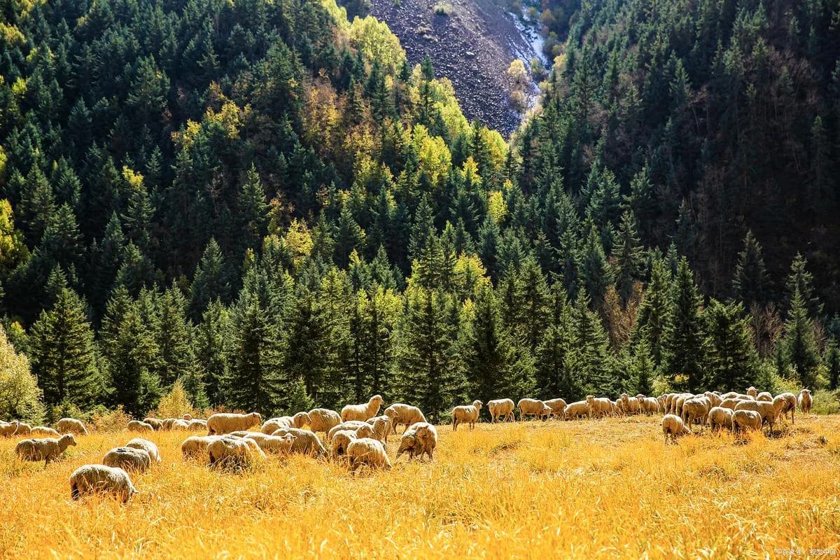
Lulang Forest & Alpine Meadows (鲁朗林海)

Affectionately called the 'Switzerland of the Orient', Lulang is an expansive highland plateau basin carpeted with dense virgin spruce and pine forests, babbling brooks, wooden alpine chalets, and lush cow pastures.

Feast on authentic Tibetan Stone-Pot Chicken cooked with wild plateau ginseng and mushrooms
Hike along peaceful wooden boardwalks through wildflower alpine meadows
Try traditional Tibetan horseback riding across the open grassland
Insider Tip:Because Lulang sits at a comfortable 3,300 meters surrounded by massive oxygen-pumping forests, it is one of the most restorative overnight stops on the road to Lhasa to refresh your energy.
阳光下的藏传佛教寺院庭院
Shigatse City (Second Largest City in Tibet)
3840m (12,600 ft)96/100 Photo Index
Tashilhunpo ('Heap of Glory')

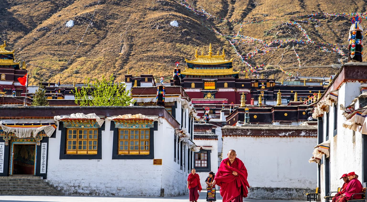
Tashilhunpo Monastery (扎什伦布寺)

Founded in 1447 by the 1st Dalai Lama, Tashilhunpo is the traditional seat of the Panchen Lamas. Sprawling across the hillside in central Shigatse, it remains one of the largest active monasteries in Tibet with over 800 residing monks.

Stand in awe before the 26.2-meter gilded copper statue of Maitreya Buddha
Visit the grand funeral stupa tombs of the 5th through 10th Panchen Lamas
Observe young novitiate monks chanting morning scriptures in the main assembly hall
Insider Tip:Walk the sacred pilgrim kora path around the perimeter of Tashilhunpo's outer red walls. The elevated path offers glorious views over the white residential quarter of Shigatse and the reconstructed Shigatse Dzong.
11ae3359ce42ca150b86d5ab562f77d6
Gongbo'gyamda, Nyingchi
3480m (11,415 ft)94/100 Photo Index
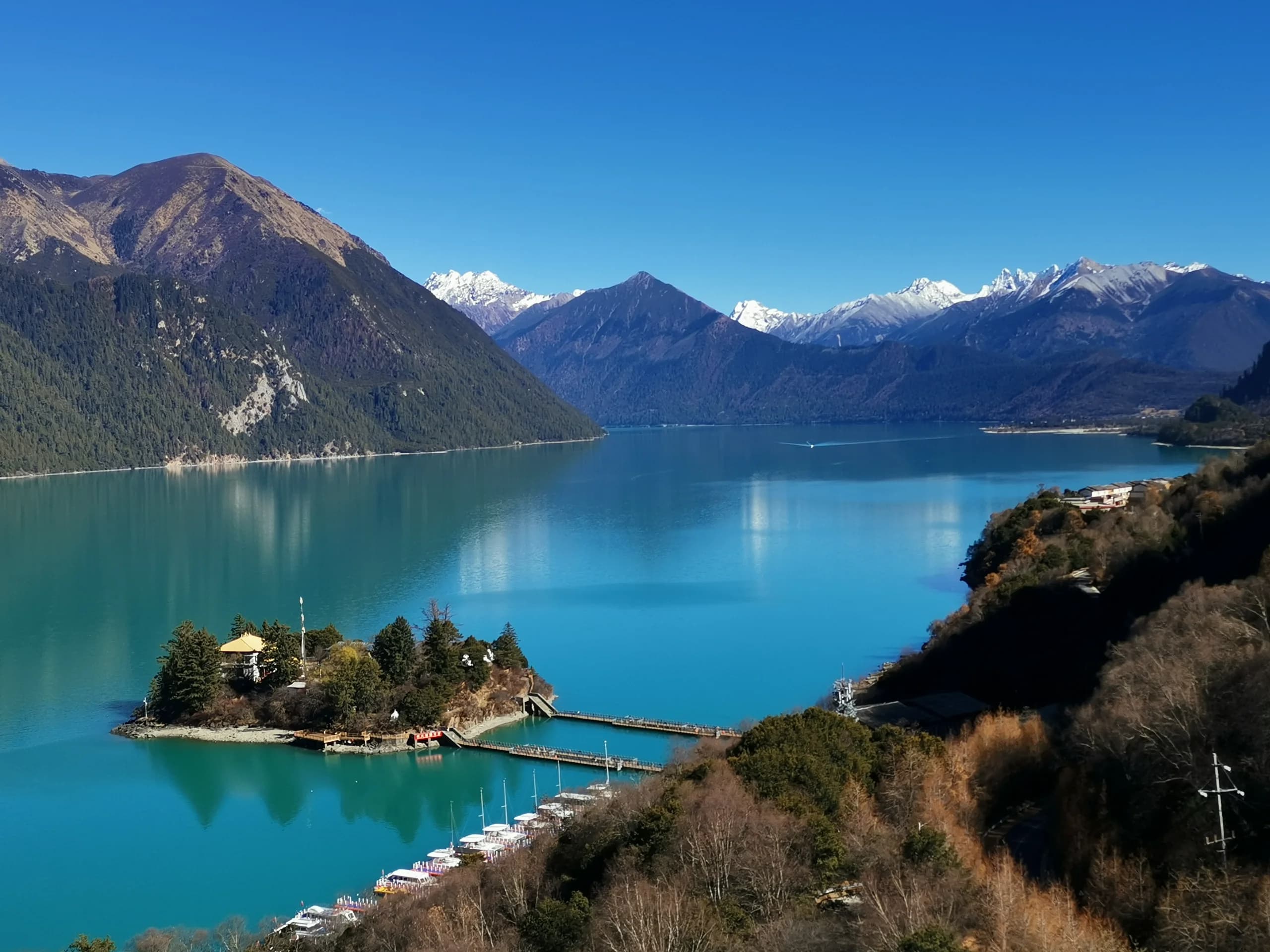
Basum Tso ('Three Rocks Lake')

Basum Tso Holy Lake (巴松措)

A crescent-shaped freshwater lake surrounded by snowy peaks and primeval pine forests. Unlike the stark high-altitude lakes of northern Tibet, Basum Tso sits at a mild 3,480m and is famous for its rich emerald water and tiny floating temple island.

Cross the scenic pontoon walkway to the peaceful forested temple island
Admire the unique 1,500-year-old Nyingma Buddhist wooden architecture
Take an electric eco-boat ride across the deep green mountain-rimmed waters
Insider Tip:Walk across the floating wooden pontoon bridge to visit Tsozong Monastery. Look for the ancient intertwined hollow pine trees regarded by local villagers as natural fertility symbols.
ebb454fcf419028db9fc3e1308471d67 (1)
Western Foot of Gambo Utse, Lhasa
3800m (12,465 ft)93/100 Photo Index
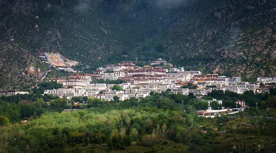
Drepung ('Rice Heap')

Drepung Monastery (哲蚌寺)

Once the largest monastery in the entire world, housing over 10,000 monks at its peak before 1959. Its countless white buildings cascade down Mount Gambo Utse like a giant heap of white rice, earning its famous name.

Walk through the historic Ganden Phodrang where early Dalai Lamas governed
Inspect the giant copper cauldrons used to brew butter tea for thousands of monks
Follow hillside pilgrim trails adorned with vibrant rock-carved Buddhas
Insider Tip:Visit the historic monastic kitchen. Monks still brew tea in giant bronze cauldrons large enough to bathe ten people. During the annual Shoton Festival in August, an immense 30-meter embroidered Buddha thangka is unfurled at dawn.
409ceb1c52a283a12ac4cd39d140b0e0
Nagarze & Gyantse Border Highway
5560m (18,240 ft)95/100 Photo Index
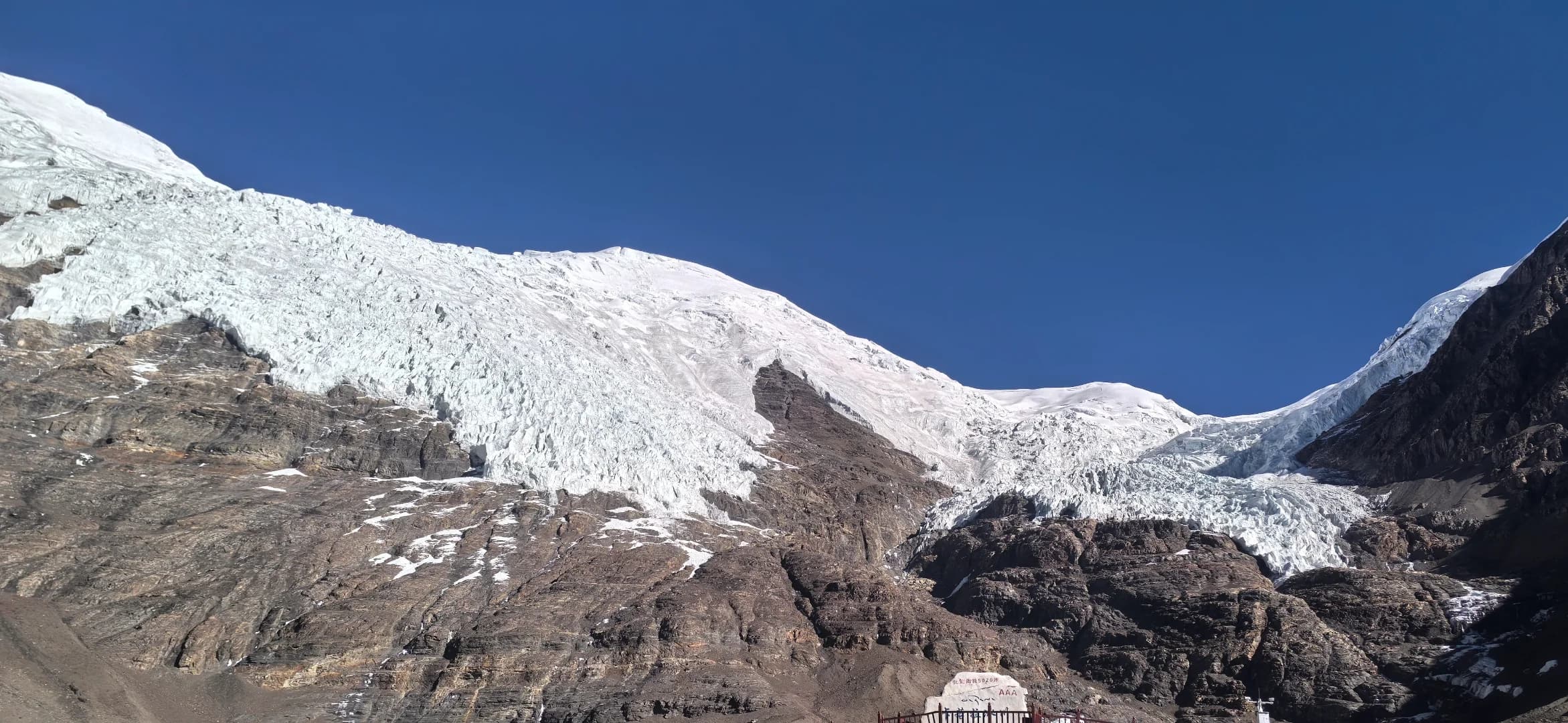
Karola Gangri

Karola Glacier (卡若拉冰川)

One of Tibet's most accessible glaciers, situated right alongside the main overland highway connecting Yamdrok Lake with Gyantse and Shigatse. Its dramatic white icecap hangs just 300 meters above the asphalt road.

Stand directly below the immense white ice serac wall tumbling from 7,191m
Wooden viewing boardwalks provide comfortable, safe proximity to the ice
Encounter Tibetan villagers in traditional sheepskin chuba robes with mountain yaks
Insider Tip:The viewing boardwalk stands at 5,020 meters (16,470 ft). High winds are constant; keep your fleece beanie, windproof jacket, and sunglasses on hand inside the vehicle before stepping out.
476a0fb2177450376b227c4d19621569
Western Suburbs, Lhasa
3650m (11,975 ft)91/100 Photo Index
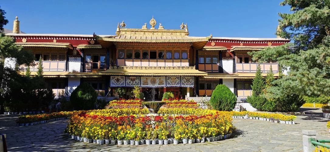
Norbu Lingka ('Jeweled Garden')

Norbulingka (罗布林卡)

Constructed in the 1750s, Norbulingka served as the beloved traditional summer palace of the 7th to 14th Dalai Lamas. Spanning 36 hectares with lush botanical gardens, shaded willow avenues, ponds, and delicate Tibetan-style palaces.

Tour the New Summer Palace built in 1954 for the 14th Dalai Lama
Admire priceless historical murals depicting the meeting of Tibetan and world cultures
Stroll the serene, shaded willow alleys away from the summer plateau heat
Insider Tip:In August during the Shoton Festival (Tibetan Yogurt Festival), local Lhasa families set up vibrant picnic tents on the lawns, drinking sweet tea, eating cold yogurt, and enjoying day-long Tibetan opera (Ache Lhamo) performances.
d2a23389ad0ddee94438b1acabf5d512
Dagzê County (45 km East of Lhasa)
4300m (14,100 ft)97/100 Photo Index
Ganden Namgyeling

Ganden Monastery & Ridge Kora (甘丹寺)

Perched dramatically like a stone fortress on the crest of Wangbur Mountain at 4,300 meters, Ganden was founded in 1409 by Je Tsongkhapa himself and stands as the foundational primary monastery of the Gelugpa (Yellow Hat) order.

Walk the unforgettable cliffside High Kora trail with hundreds of fluttering prayer flags
Look down thousands of feet into the braided channels of the Lhasa River basin
Visit the holy tomb stupa of Gelugpa founder Je Tsongkhapa
Insider Tip:Do NOT miss the Ganden High Kora path! The 45-minute walking trail wraps around the mountain ridge above the monastery, revealing an awe-inspiring 360-degree aerial view of the turquoise Lhasa River (Kyi Chu) valley.
Altitude Planning & Acclimatization

Tibet Elevation in Feet Across Major Milestones

Understand the dramatic elevation climb across Tibetan highlights. Visiting higher sites like Namtso or Mount Everest requires proper step-by-step adaptation starting in lower elevations.

Chengdu (Basin Base)Safe Departure Hub
1,640 ft(500m)
Effective Oxygen: 95% (Sea level baseline)
Lulang & Nyingchi (Forest Valley)Gentle Highland Sleep
9,840 ft(3,000m)
Effective Oxygen: 75% (High forest oxygen)
Lhasa & Jokhang (Capital)Primary Sightseeing Base
11,975 ft(3,650m)
Effective Oxygen: 68% (Standard Tibetan City)
Yamdrok Lake PassDay Excursion Viewpoint
14,570 ft(4,441m)
Effective Oxygen: 59% (High Alpine Pass)
Namtso Heavenly LakeRequires 4 Days in Lhasa
15,480 ft(4,718m)
Effective Oxygen: 56% (Very High Plateau)
Dongda Mountain Pass (G318)Brief 20-min Photo Stop
16,830 ft(5,130m)
Effective Oxygen: 54% (Highway Crest)
Everest North Base CampMedical Oxygen on Hand
17,060 ft(5,200m)
Effective Oxygen: 52% (Extreme Elevation)
Mount Everest SummitClimbing Expedition Only
29,031 ft(8,848m)
Effective Oxygen: 33% (Death Zone)
Need detailed medical advice on Diamox prescriptions and high-altitude symptoms?
Read our Comprehensive Altitude Preparation Guide →
Seasonal Planning

When is the Best Season to Visit Tibet's Sights?

Tibet experiences dramatic seasonal shifts. Review weather, day and night temperatures, and optimal sightseeing activities across the four distinct plateau travel windows.

Spring (Peach Blossoms & Clear Peaks)

April – May
14°C to 20°C (57°F – 68°F)
Night: 0°C to 5°C (32°F – 41°F)

Clear sunny skies, dry roads, zero monsoon rains, snowy peaks sparkling.

Recommended Sights in this Window:
Photograph wild pink peach blossoms in Nyingchi with snow-capped Namcha Barwa in the backdrop
Hike along Yamdrok Lake shoreline with crystal turquoise reflections
Visit Potala Palace and Jokhang with mild pleasant daytime walking temperatures
Exceptional visibility for Mount Everest North Face viewing before summer clouds
Travel Verdict:Optimal Sweet Spot: Moderate crowds, good flight availability, comfortable hotel rates.

Summer (Lush Meadows & High Oxygen)

June – August
18°C to 25°C (64°F – 77°F)
Night: 9°C to 14°C (48°F – 57°F)

Warmest season with the highest ambient oxygen levels. Periodic afternoon rains.

Recommended Sights in this Window:
Witness vibrant nomadic horse festivals in Litang and northern grasslands
Experience the colorful Shoton Festival at Drepung and Norbulingka in August
Enjoy lush green forests in Lulang and Bomi along G318
Pleasant warm evenings strolling along Barkhor Street teahouses
Travel Verdict:Peak Season: Potala Palace tickets are heavily sought after; advance booking essential.

Autumn (Golden Foliage & Starry Skies)

September – October
15°C to 21°C (59°F – 70°F)
Night: 1°C to 6°C (34°F – 43°F)

The golden season: rain completely ceases, crystalline deep sapphire skies.

Recommended Sights in this Window:
The undisputed finest season for Mount Everest Base Camp and Himalayan mountain passes
Capture the golden larch and poplar forests along Ranwu Lake and Bomi
Experience Sera Monastery outdoor debates under crisp autumn sunshine
Stargaze at high elevation with zero cloud cover and luminous Milky Way views
Travel Verdict:High Demand in October Golden Week; late September and mid-October are perfection.

Winter (Spiritual Pilgrimage & Solitude)

November – March
8°C to 12°C (46°F – 54°F)
Night: -5°C to -10°C (23°F – 14°F)

Crisp, dry, and intensely sunny. Lhasa enjoys over 300 days of sunshine a year.

Recommended Sights in this Window:
Join authentic nomadic pilgrims visiting Lhasa for winter religious ceremonies
Zero crowd lines at Potala Palace and Jokhang Temple
Spot endangered Black-Necked Cranes wintering in the valleys of Linzhou
Benefit from winter scenic ticket discounts and luxury hotel promotional rates
Travel Verdict:Budget-Friendly: Lowest hotel costs, intimate authentic atmosphere, colder nights.
Seamless Overland Connection

How to Experience These Sights via National Highway 318

Rather than flying directly into Lhasa, our private chartered 4WD journeys connect the most stunning mountain passes, holy lakes, and ancient monasteries in one continuous expedition.

12-Day Classic Overland Route

Chengdu to Lhasa Epic Road Journey

The definitive overland crossing along National Highway 318. Traverses 14 mountain passes, Ranwu Lake, Midui Glacier, 72 Bends, Tongmai Bridge, and culminates in 2 full days in Lhasa visiting Potala Palace, Jokhang Temple, and Barkhor Street.

Includes private licensed 4WD vehicle and veteran Tibetan driver
Tibet Travel Permit (TTP) and English Tibetan guide included
Advance Potala Palace official time-slot reservation guarantee
Tested Pace:
12 Days / 11 Nights
View 12-Day Itinerary →
14-Day Acclimatization Deep Dive

14-Day Measured Pace & Deep Immersion

Adds two crucial rest buffer days in Batang and Lulang Forest. Delivers a relaxed, unhurried photographic rhythm, extra rest to prevent acute mountain sickness, side excursion to Namcha Barwa, and 3 full leisurely days in Lhasa.

Extra low-elevation rest nights in Batang (2,580m) and Bomi (2,750m)
Side exploration of Lulang Alpine Meadows & Namcha Barwa viewpoint
Visits to both Sera Monastery Debates and Drepung Monastic Kitchen
Tested Pace:
14 Days / 13 Nights
View 14-Day Itinerary →
Expert Travel Advice

Frequently Asked Questions about Tibet Places of Interest

Everything you need to know regarding permits, booking timelines, high altitude, and cultural customs.

If you have limited days, your top 5 non-negotiable highlights are: 1) Explore the awe-inspiring Potala Palace in Lhasa; 2) Join devout pilgrims walking clockwise around Jokhang Temple and Barkhor Street; 3) Gaze at the otherworldly turquoise waters of Yamdrok Lake; 4) Watch the dramatic afternoon monk debates at Sera Monastery; and 5) If time permits, journey overland to witness the north face of Mount Everest at Rongbuk Base Camp.
100% Zero-Shopping Itinerary Guarantee

Ready to Experience the Wonders of Tibet First-Hand?

Tell us your preferred travel month, party size, and comfort priorities. Our Chengdu team will assemble an itemized, transparent proposal with licensed commercial 4WD vehicles and guaranteed Tibet Travel Permits.
Start Planning Your Tibet TripExamine 2026 Price Breakdown
Verified Lhasa Bureau TTP PermitsNo Forced Commission Shopping StopsContinuous In-Vehicle Oxygen Support
2026/2027 Verified Field Intelligence Dossiers

Look Inside Before You Decide

Tested across 5,144 physical survey assets. Zero generic fluff. Inspect authentic sample pages from both dossiers below, then choose your digital expedition pack.

Product 1 · Self-Drive Safety & Medical Blueprint

G318 Overland Survival & Road Field Manual (104 Pages)

Inspect authentic interior pages: real in-vehicle telemetry logs, low-altitude safe havens, high mountain pass profiles, and clinical AMS protocols.

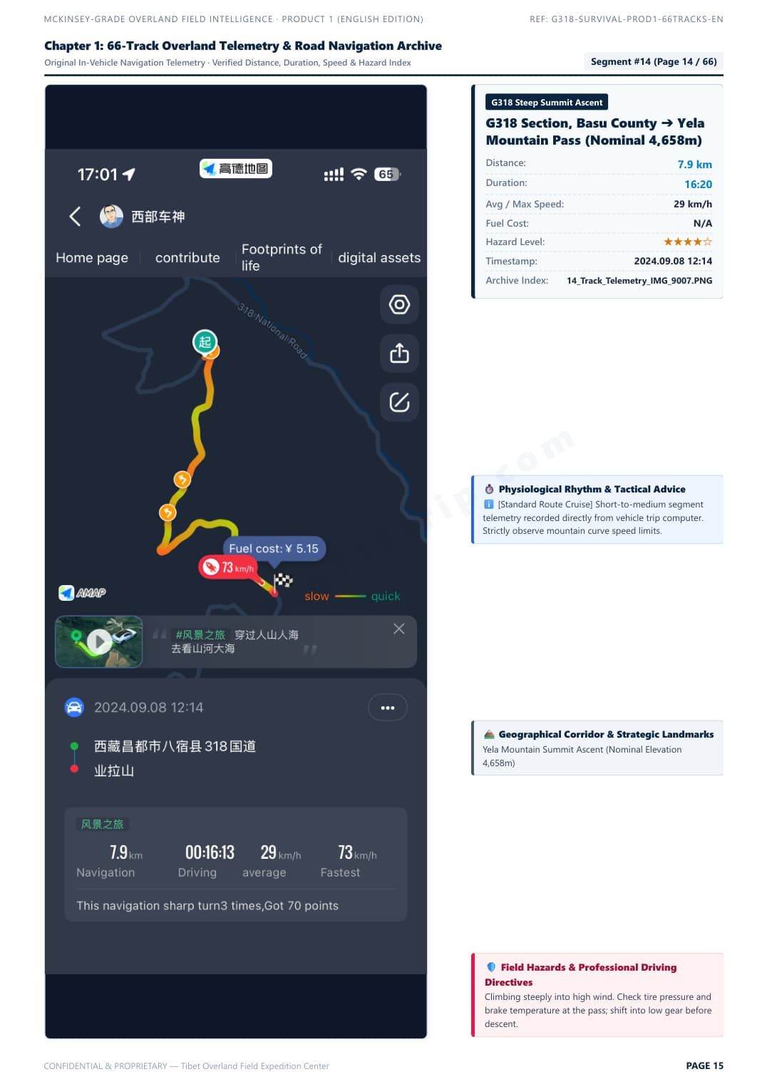
Telemetry Track & Blind Curve Protocol
Field Survey Baseline: Autumn 2024 · 2026/2027 Road Status Verified
Click to Enlarge Page

Telemetry Track & Blind Curve Protocol

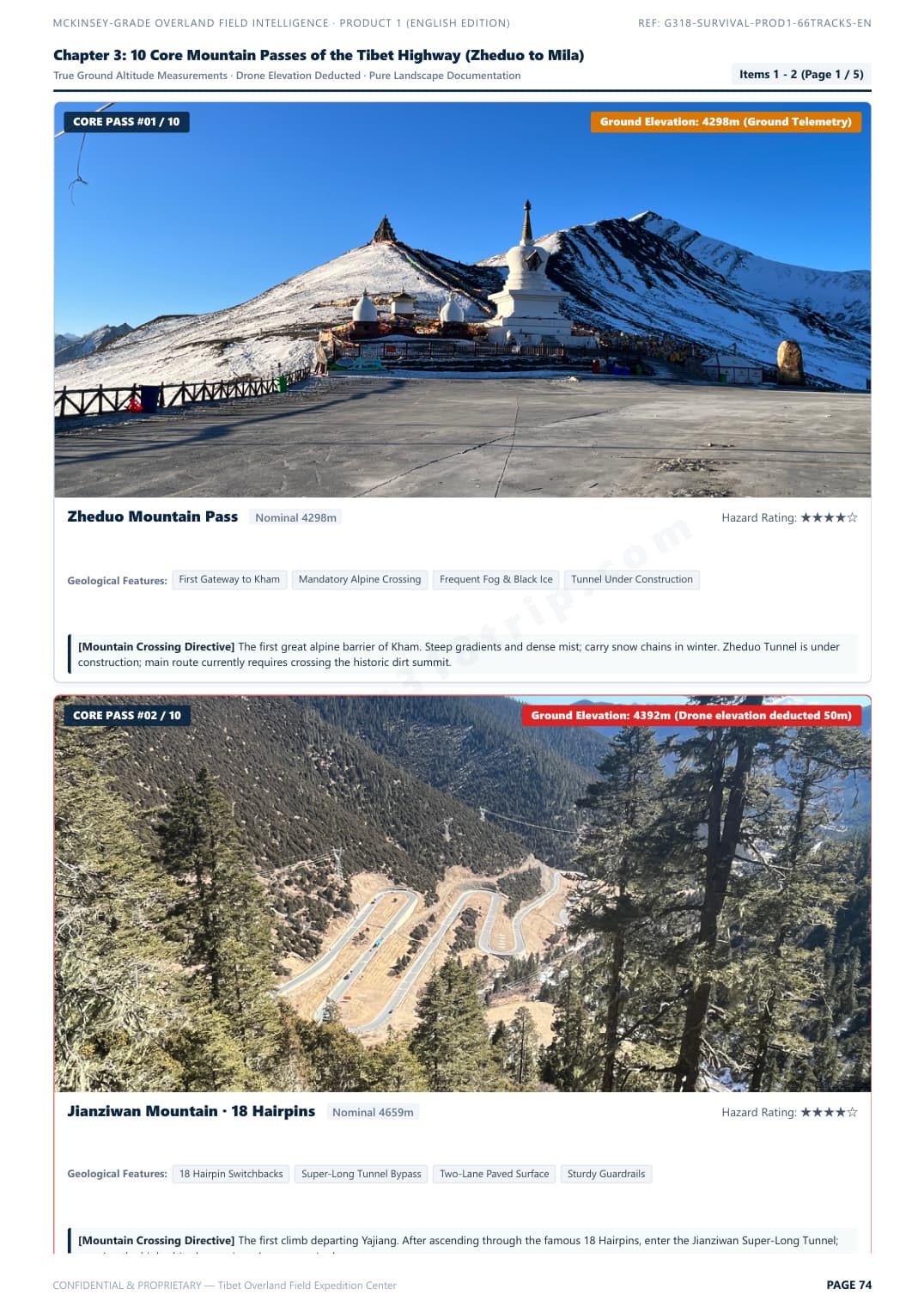
Segment #15: Zheduo Pass ➔ Xinduqiao. Real in-vehicle telemetry with elevation curve, average speed, and overtaking tactics.

Verified Raw DossierZoom
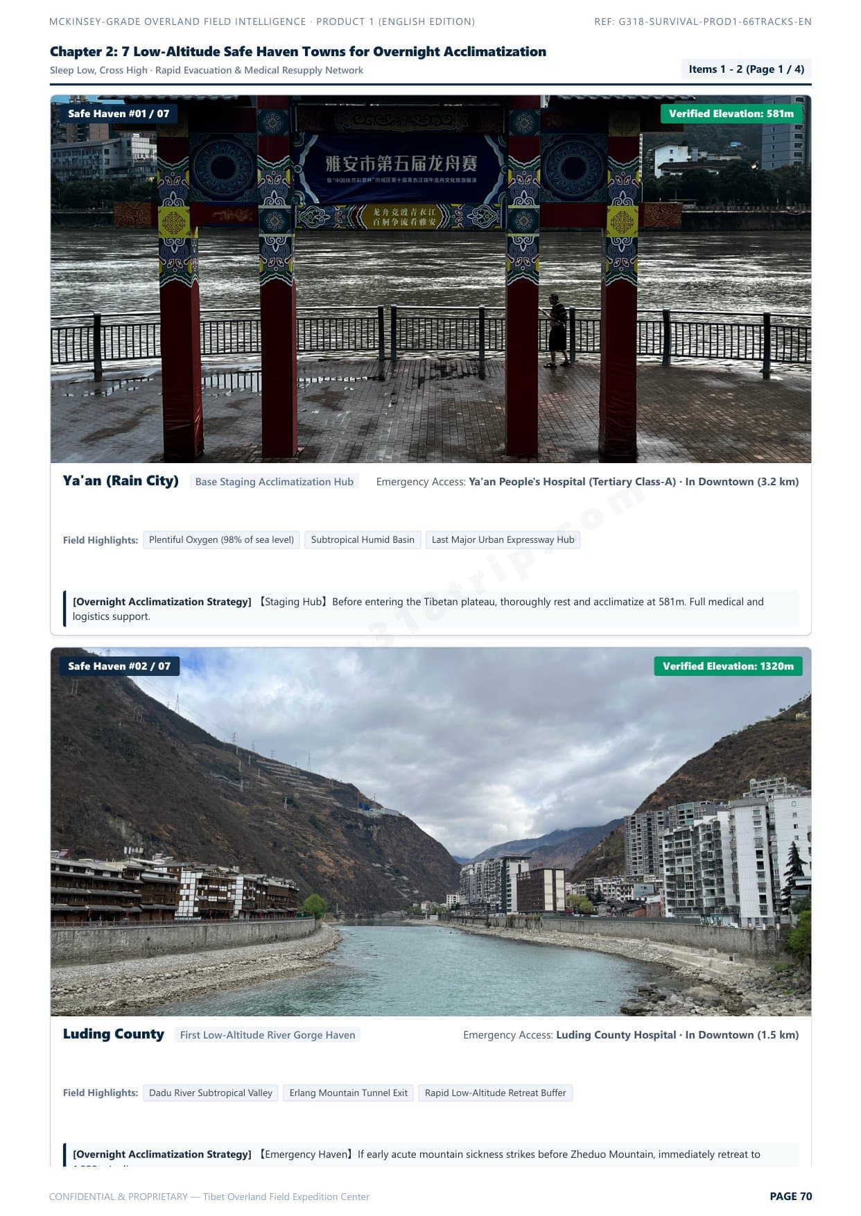
7 Low-Altitude Safe Haven Towns
Clinical Acclimatization Map
Click to Enlarge Page

7 Low-Altitude Safe Haven Towns

Scientific hypoxia staging strategy: sleep low, climb high. Safe night stop elevations and rapid emergency descent corridors.

Verified Raw DossierZoom
10 Core Mountain Passes Clearance Guide
Pass Bottleneck Profiles
Click to Enlarge Page

10 Core Mountain Passes Clearance Guide

Zheduo, Haizi, Dongda, Mila passes. Real gradients, road surface conditions, and vehicle chassis clearance ratings.

Verified Raw DossierZoom
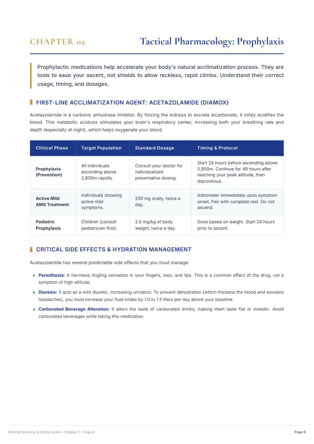
Hospital-Grade AMS Clinical Protocol
Emergency Medical Directive
Click to Enlarge Page

Hospital-Grade AMS Clinical Protocol

25-page acute mountain sickness emergency protocol, S.O.A.D. rapid descent workflow, and prescription medication matrix.

Verified Raw DossierZoom
↓ Choose Your Complete Uncensored Digital Pack Below ↓
Product 1 · Self-Drive Safety & Road Pass Dossier

G318 Overland Survival & Road Field Manual

The definitive self-drive road intelligence blueprint. Solves chassis clearance hazards, certified low-elevation sleep staging, and clinical acute mountain sickness protocols.

$39.90USD · Standalone Edition
Detailed Inclusions & Rights (全部实测权益):
66 Verified In-Vehicle Telemetry Tracks: Chengdu ➔ G318 South ➔ Lhasa ➔ Yamdrok Loop ➔ G317 North ➔ Chengdu Return Loop
10 Core Mountain Passes with Real Gradients & Clearance Ratings (Zheduo, Haizi, Dongda, Mila, etc.)
7 Golden Low-Altitude Overnight Sleep Havens (Safe Hypoxia Staging at Batang, Bomi, Nyingchi & more)
Mountain Road Blind Curves & Heavy Truck Overtaking Survival Rules (Break out of multi-mile slow convoys)
8 Severe Geohazard Blackspots (Active rockfalls, mudslides, riverbed washouts & black ice traps)
25-Page Hospital-Grade Acute Mountain Sickness (AMS) Clinical Protocol & Prescription Drug Matrix
Bilingual Medical & Police Emergency Flashcards (English & Chinese with phonetic pinyin)
100% Offline Access: High-Definition Mobile PDF (Zero cell signal needed on mountain passes)

Instant Single-File PDF Delivery (91 MB) · Standalone Survival Manual

Product 2 · Creators & Aerial Takeoff Archive

G318 Master 100 Drone & Photo Waypoints Pack

Dedicated visual takeoff archive. 100 curated spots with verified DJI EXIF coordinates, true ground elevations, golden-hour lighting windows, and universal offline map files.

$79.90USD · Standalone Edition
Detailed Inclusions & Rights (全部实测权益):
100 Curated Drone & Camera Master Waypoints (5 Thematic Chapters: Holy Mountains, Glaciers, Passes, Lakes, Kham Culture)
Extracted from Real DJI Drone EXIF Flight Data with Dual WGS-84 (Garmin/Google Earth) & GCJ-02 (Amap/Ovital) Coordinates
True Ground Elevations (Strictly Subtracted Drone Takeoff Altitudes for Precise Real-World Planning)
Universal Offline Map Pack: Ready-to-import KML files for Ovital Map, Amap (高德), and Google Earth + Excel/CSV Master Sheet
Calculated Golden Hour Lighting Windows & Sun Angles for Glaciers, Mountain Passes & Canyon Gorges
Pass-Specific & Canyon Safe Takeoff Protocols, Compass Calibration Rules & Gale-Force Wind Warnings
52-Page High-Res Illustrated English Drone Master Dossier (Full 100 Takeoff Spots with Visuals)
Instant Digital Delivery Archive (~24 MB): Illustrated PDF + Universal KML + Master Excel Sheet

Instant Digital Download (~24 MB): 52-Page Master PDF + KML Waypoints + Excel Sheet

👑 COMPLETE EXPEDITION PACKAGE · THE DEFINITIVE CREATOR BUNDLE
Best Value Deal · Save $19.90 USD

G318 Ultimate Overland & Creator Bundle

The all-in-one expedition master suite. Combines Product 1 (66 Telemetry Tracks Road Survival Manual) AND Product 2 (100 Verified Drone Waypoints Archive, Universal KML Maps & Master Excel Sheet) at a discounted package price.

$119.80$99.90USD · Full Bundle
Instant delivery of all PDF manuals, KML map files & photo archives
Everything Included in This Master Bundle (包含全部两大产品权益):
✓ INCLUDES COMPLETE PRODUCT 1: G318 Overland Survival & Road Field Manual ($39.90 Standalone Value)
✓ INCLUDES COMPLETE PRODUCT 2: Master 100 Drone & Photo Waypoints Pack ($79.90 Standalone Value)
66 Verified In-Vehicle Telemetry Tracks (Full Loop: Chengdu ➔ G318 ➔ Lhasa ➔ Yamdrok ➔ G317 ➔ Chengdu)
100 Verified Drone Takeoff Spots with Real DJI EXIF Coordinates & True Ground Elevations
Universal Offline KML & CSV Navigation Packs (Ready to import to Ovital Map, Amap, Google Earth & Garmin)
10 High-Altitude Passes with Elevation Profiles, Clearance Ratings & True Gradients
7 Golden Low-Altitude Overnight Sleep Havens (Safe Hypoxia Staging at Batang, Bomi, Nyingchi, etc.)
Mountain Road Blind Curves & Heavy Truck Overtaking Tactics (Break out of multi-mile convoys)
8 Severe Geohazard Blackspots (Landslides, debris flows, riverbed washouts & freeze-thaw ice traps)
25-Page Hospital-Grade Acute Mountain Sickness (AMS) Clinical Acclimatization & Rx Drug Protocol
Calculated Golden Hour Lighting Windows & Sun Angles for Glaciers, Mountain Passes & Canyon Gorges
Pass & Canyon Safe Takeoff Protocols, Compass Calibration Rules & Gale Wind Warnings
Bilingual Medical & Police Emergency Flashcards (English & Chinese with phonetic pinyin)
Instant Digital Delivery Archive (~40 MB Total): Illustrated PDFs + Universal KML + Master Excel Sheets
Unlock Complete 2027 Overland & Drone Master Package
Single-click payment via Stripe with immediate authenticated download link generated.
256-Bit Encrypted Stripe Checkout100% Offline Access · No Cell Signal NeededSupports Apple Pay, Google Pay, Visa & Amex